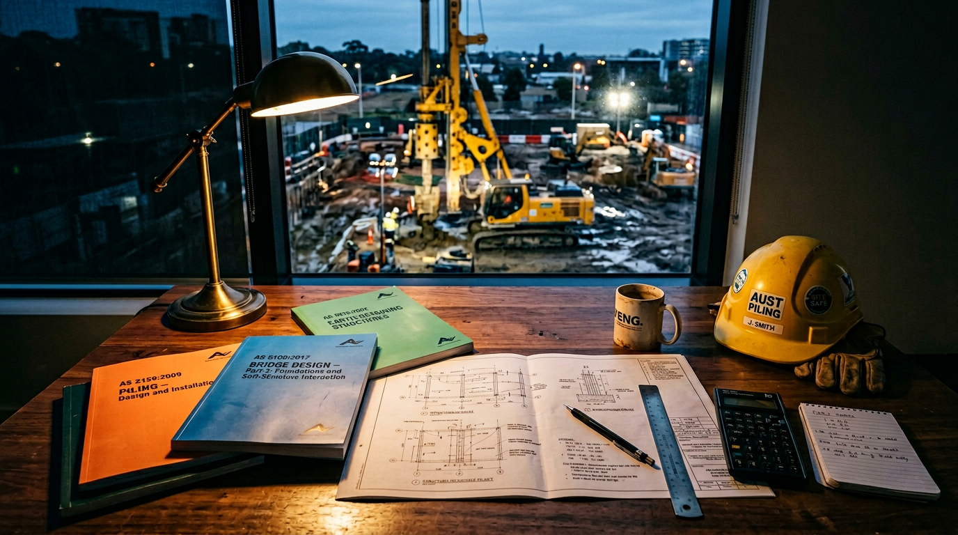
A piling contractor can only be as good as the geotechnical report handed over. A thirty-page glossy with stock-photo covers and no borehole logs will not let us design a pile schedule that stands up. Conversely, a terse fourteen-page report with the right information is gold.
This is what we look for in a geotech report — and what we flag back to the consulting engineer when the information is missing.
1. The cover and the site plan
What must be there:
- Site address and coordinates.
- Date of investigation.
- Author and their NER/CPEng registration number.
- Site plan showing every borehole, test pit and CPT at its exact location, with RLs referenced to Australian Height Datum (AHD) or a clearly stated local datum.
Red flags: no coordinates, no chainage, no reference datum. These become material when we try to reconcile pile locations against borehole depths on a complex linear project.
2. The investigation scope
What must be there:
- Number of boreholes, CPTs and test pits, and whether they align with AS 1726 / AS 2159 requirements for the intended pile type.
- Depth of each borehole — and the reason it was terminated. “Terminated at 12 m at client instruction” is very different from “terminated at refusal in fresh basalt at 12 m.”
- Groundwater observations: standing level during drilling, steady-state level after 24 h, piezometer readings if installed.
Red flags: a single borehole for a large site; all boreholes terminating at the same depth; no groundwater observations.
A rough rule under AS 2159: one borehole per 100–200 m² of plan for structures sensitive to differential settlement. For a civil project we would expect one borehole at each pier or abutment, plus additional holes at every suspected strata change.
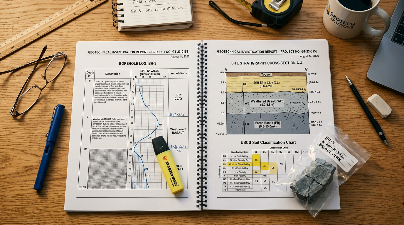
3. The borehole log — the most important page
The borehole log is the single most important document in the report. On it we read:
- Depth column with clear RL cross-reference.
- Lithology description — soil or rock type, colour, grading, moisture condition.
- AS 1726 classification — CH, CL, SM, etc.
- Strength description — soft / firm / stiff / very stiff for clays; loose / medium-dense / dense for sands.
- SPT blow counts at regular intervals (typically every 1.5 m) with Sample Penetration Test correction factors.
- Sampling record — U50/U75 undisturbed samples, disturbed bag samples, continuous core in rock.
- Groundwater — dashed line at observed level(s).
- Termination reason.
What we want in rock:
- UCS (unconfined compressive strength) from point-load or uniaxial test.
- RQD (rock quality designation) as a percentage at each core run.
- Weathering grade (W1–W6 or equivalent).
- Jointing and discontinuity description.
Red flags: no SPT data (just a description); no shear-strength values in cohesive soils; no UCS or RQD in rock zones; no sketch of the core box.
4. The laboratory results
Results that must be tabulated:
- Atterberg limits (LL, PL, PI) on clay samples.
- Moisture content on all recovered samples.
- Unit weight — dry and wet.
- Shear strength — UU triaxial or direct shear on cohesive samples, cone penetration results on sandy ground.
- Consolidation tests where long-term settlement matters.
- Rock UCS on cores from founding strata.
And for reactive-clay sites:
- Linear shrinkage or shrink-swell test results.
- AS 2870 classification (S, M, H1, H2, E, P).
Red flags: Atterberg results with no shear data; shear data with no moisture content; classification without in-situ suction measurements on reactive sites.
5. The cross-section and stratigraphy model
A good geotech report produces a longitudinal and cross-section through the site showing the stratigraphy interpreted from the boreholes. This is the single best visualisation for piling design because it shows:
- Where the top of the founding stratum sits across the site.
- Where it is deepest and shallowest.
- How the layers dip across the site.
- Where perched water tables sit.
Red flags: no interpreted cross-section; rock contacts joined in straight lines across distant boreholes without acknowledgement of uncertainty.
6. The recommendations section
A competent recommendations section for piling should address:
- Pile type recommendations — what the geotech considers feasible and why.
- Design parameters for each stratum:
- Ultimate shaft friction in each layer (kPa).
- Ultimate end-bearing in founding strata (MPa).
- Undrained shear strength for cohesive layers.
- Modulus or subgrade reaction for lateral analysis.
- Unit weight and saturated unit weight.
- Founding horizon criteria — the rock or stratum the piles should found in, with a description robust enough for the site engineer to identify in the field.
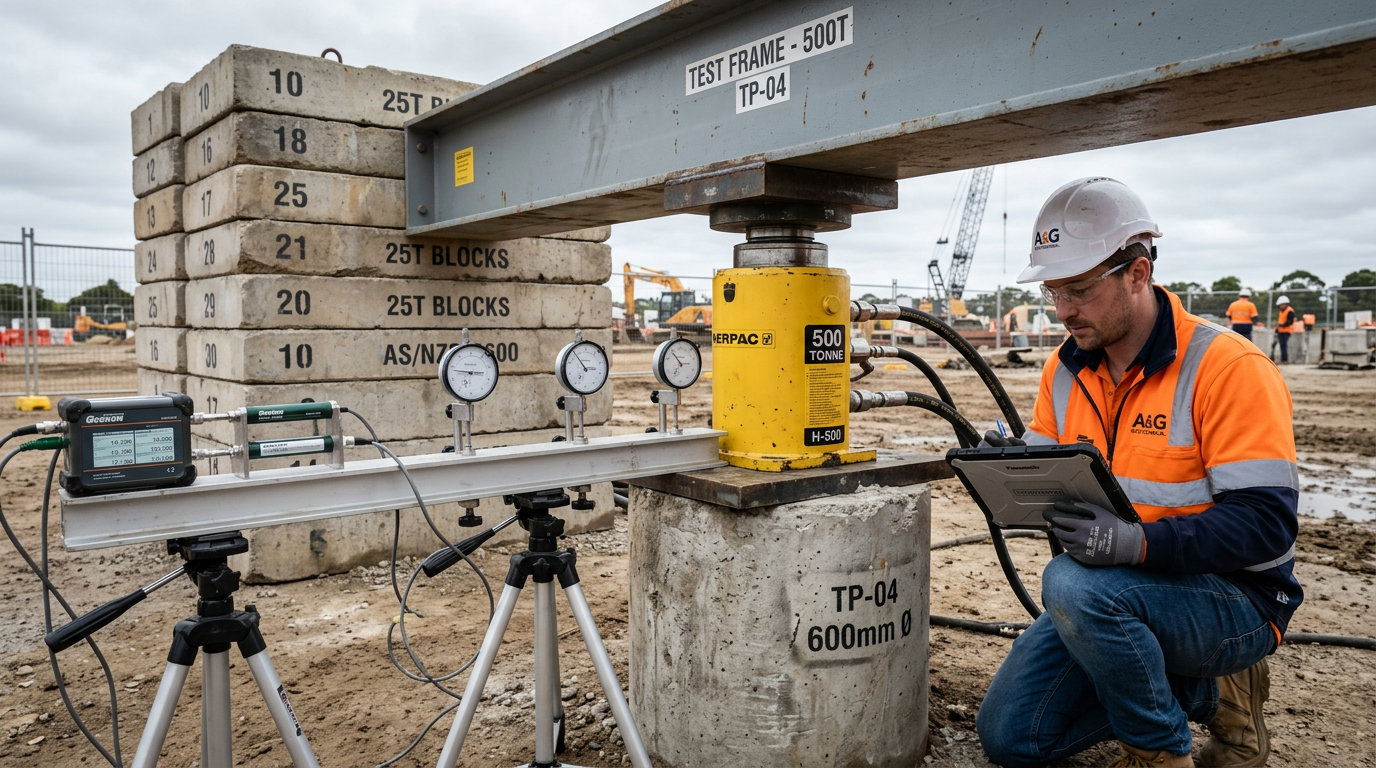
- Groundwater considerations.
- Construction observations — drilling issues expected, groundwater inflow rates, potential for collapse or hole instability.
- Aggressive ground chemistry — sulfate, chloride, pH results if relevant for buried concrete and steel durability.
Red flags: recommendations that are hedge-all (“any suitable piling method”); no numerical design parameters; no distinction between ultimate and allowable values.
7. The four parameters we cannot work without
If we get a report that is light on detail, we will ask for these four minima before quoting:
- Ultimate shaft friction (kPa) in each stratum. The single parameter that drives pile length.
- Ultimate end-bearing in the founding stratum. Drives the socket length.
- Groundwater level — observed or interpreted. Drives temporary casing decisions and dewatering strategy.
- Founding-horizon description that a site engineer can identify by eye and by drilling behaviour.
Without these four, the design is guesswork. With them, we can put a reliable number in a tender.
8. Reports we occasionally see that we send back
Three patterns that are not fit for piling design, and what we request instead:
8.1 “Settlement analysis” reports without shear-strength data
Common when a geotech has been scoped for a residential slab and reused for a commercial structure. We ask for a pile-design addendum with shear parameters.
8.2 Single-borehole reports on ≥ 500 m² footprints
We ask for at least three more, preferably one per major pad.
8.3 “Rock was encountered at [borehole depth]” with no UCS, RQD or core photos
We ask for laboratory testing of retrieved core, or a targeted re-investigation if the cores are gone.
9. Our process on handover
When a consulting engineer sends us a geotech and structural drawings for a tender, we:
- Read the geotech in full.
- Flag any missing parameters in a written query back to the engineer.
- Produce a pile schedule against the engineer’s loadings using the report’s parameters.
- State in writing the assumptions we have made where parameters were not explicit.
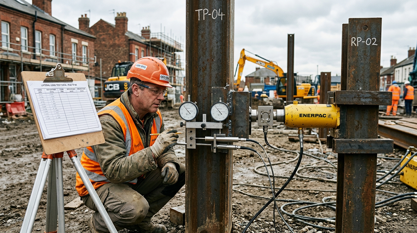
- Nominate a test programme to verify the assumptions.
That process — geotech review, written queries, transparent assumptions — is how we avoid mid-project arguments about capacity, depth and cost.
10. Two minutes to check a report is usable
A quick triage for a busy engineer:
- Open the borehole log — is there SPT and shear data?
- Find the groundwater note — is there one?
- Find the recommendations — are there numerical design parameters for each stratum?
- Check the investigation scope against site area — one borehole per 100–200 m²?
Four quick questions. If the answer to any of them is no, the report is not yet ready for piling design.
Got a geotech report you want a second opinion on? Send it to info@vicpiling.com.au or call 0466 651 881.
References
- Standards Australia, AS 1726:2017 — Geotechnical Site Investigations.
- Standards Australia, AS 1289 — Methods of testing soils for engineering purposes (complete series).
- Standards Australia, AS 2159:2009 — Piling: Design and Installation.
- Look, B. G., Handbook of Geotechnical Investigation and Design Tables, 2nd ed., CRC Press, 2014.
- Mayne, P. W., Coop, M., Springman, S., Huang, A.-B. & Zornberg, J., “Geomaterial Behavior and Testing”, Proc. 17th ICSMGE, 2009.
Article technically reviewed by a chartered civil/geotechnical engineer (CPEng, MIEAust).
VIC PILING is a specialist piling contractor delivering tier-1 civil, energy, rail and commercial foundations across Victoria since 2016. Our principals bring 30+ years of combined design, installation and compliance experience under AS 2159, AS 5100 and AS 4678.